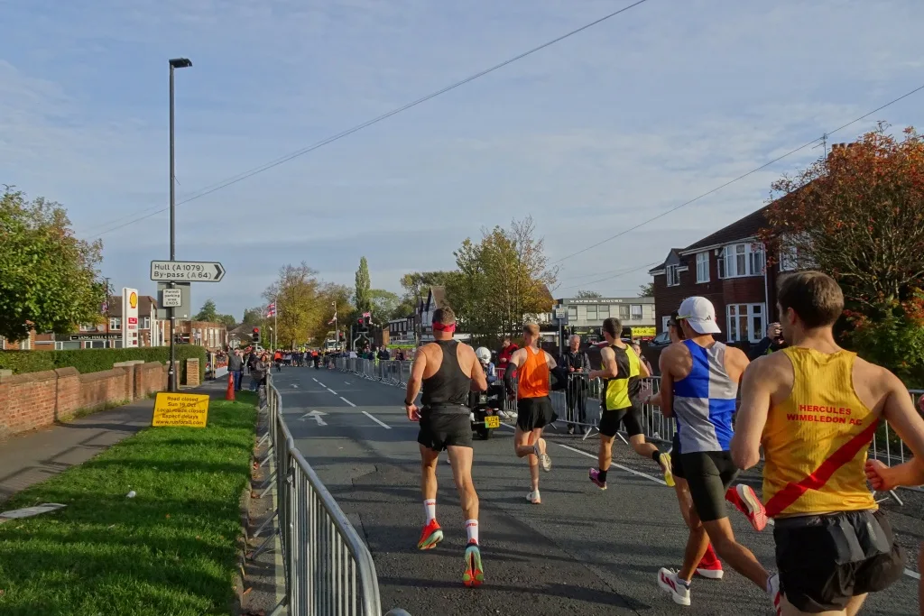

Sunday 18 October: Hull Road shuts 09:30 to 17:30, the city centre 08:00 to 11:45, University Road from Saturday 10am. Plus the five best spots to watch.
The Altra Yorkshire Marathon is Sunday 18 October 2026. The marathon starts at 09:30 and the Yorkshire 10 Mile at 10:15, both from University Road at the University of York, and the last runner is expected in at 17:30 (Run For All; Heslington Parish Council, 25 May 2026).
Updated 4 October: Run For All’s 2026 race magazine is out, with a where-to-watch guide and spectator shuttle times, added below. First York has still posted no bus diversions.
Updated 2 October: Run For All has now published its 2026 road closure poster, which adds Clifford Street and George Street to the city centre closure. The organiser’s map also now shows drop-off loops, a bus-only Windmill Lane and residents’ access routes, all below. First York has still posted no diversions.
The full 2026 closure schedule is published in two places: the organiser’s 2026 Yorkshire Marathon Road Closures map and the 2026 road closure poster, a Word document linked from the event page. The tables below are both, read out in full and rechecked on 2 October. The poster says all times are approximate and subject to change, and that any road crossing or joining a listed road is closed at that point too.
The one to know about if you are not going anywhere near the race
University Road closes from 10:00 on Saturday 17 October until 23:00 on Sunday 18 October, between Innovation Way and Green Dykes Lane. That is a day and a half, and it starts the day before the race.
Watch out for one thing here. The map’s own pin for that closure reads “from 10:00 Saturday 18th October to 23:00 Sunday 19th October”. Those are last year’s dates: the 2025 marathon was Sunday 19 October. The folder heading the pin sits in has it right, as Saturday 17th to Sunday 18th, and 18 October 2026 is a Sunday. Go with the folder.
Sunday 18 October, closure by closure
06:00 to 16:00
| Road | Detail |
|---|---|
| A166 | Access to Buttercrambe, Sand Hutton or the A64 is available from 14:00 via Stamford Bridge (A166), Buttercrambe Road and Buttercrambe Moor |
| Church Balk, Dunnington | Whole road |
| Church Street, Dunnington | Whole road |
| Eastfield Lane, Dunnington | Whole road |
| Stockhill Close | Whole road |
06:00 to 18:00
| Road | Detail |
|---|---|
| Green Dykes Lane | See the Thief Lane crossing point below |
| Heslington Lane | Whole road |
| Main Street, Heslington | Heslington Lane to University Road and Field Lane |
08:00 to 11:45, the city centre
Hull Road (A1079) from Melrosegate to Lawrence Street, Lawrence Street (A1079) from Hull Road to Barbican Road, Barbican Road from Lawrence Street to Cemetery Road, Walmgate from Lawrence Street to Fossgate, Foss Islands Road at the Lawrence Street and Walmgate junction, Foss Bank at the roundabout, Piccadilly from Lead Mill Lane to Parliament Street, Parliament Street from Pavement and Piccadilly to Davygate, High Ousegate, Spurriergate, Coney Street, St Helen’s Square, Davygate from Parliament Street to Blake Street, Blake Street between Davygate and Duncombe Place, Duncombe Place, Minster Yard, Deangate, Goodramgate from Deangate to Monkgate, Monkgate from Goodramgate to Heworth Green, Lord Mayor’s Walk at the Goodramgate and Monkgate junction, Jewbury, St Maurice’s Road and St Deny’s Road. The 2026 poster also lists Clifford Street and George Street in this 08:00 to 11:45 zone, though neither has a pin on the map.
08:30 to 12:30
A1036 Heworth Green from Foss Bank to Stockton Lane, Stockton Lane, Hopgrove Lane South at the Stockton Lane junction, Sandy Lane and The Village at Stockton on the Forest. Access out of Stockton Lane, Sandy Lane and The Village is kept until 09:15 only, and only by the routes named on the map: Heworth Green roundabout towards Malton Road and Heworth Road from Stockton Lane, and Barr Lane and Common Lane to the A64 from the other two.
09:15 to 13:15 or 14:15
Common Lane from Sandy Lane to Northgate Lane, Northgate Lane, Upper Helmsley and Main Street at Sand Hutton all close 09:15 to 13:15. Buttercrambe Moor Wood, from Main Street to the A166, closes 09:15 to 14:15.
09:30 to 16:30 and 16:45
Holtby Lane, Rudcarr Lane and Straight Lane close until 16:30. Bad Bargain Lane, Moor Lane and Sandy Lane between Holtby Lane and Bad Bargain Lane close until 16:45.
09:30 to 17:30, the long one
Hull Road, Osbaldwick Lane, Osbaldwick Village from Murton Way to Osbaldwick Lane, Tang Hall Lane from Osbaldwick Lane to Hull Road, and Murton Way from Moor Lane to Osbaldwick Village. This is the closure that lasts nearly eight hours. The published diversion, in place 08:00 to 17:30, is to use the A64 towards Fulford Road, then Tower Street and Nunnery Lane for the railway station.
Crossing points, which are the part people miss
The map marks several places where vehicles are let across the course, and the windows are narrow.
- Walmgate Bar, the Foss Islands Road and Barbican Road crossing, is open until 09:25, then marshalled crossings run 09:45 to 10:10, the point is restricted 10:10 to 10:30, and it reopens fully at 10:45.
- Heworth Road roundabout crossing runs until 09:25 and reopens at 11:25.
- Thief Lane, off Green Dykes Lane, crosses freely 10:30 to 11:00, then when it is safe to do so until 18:00.
- Garrow Hill Avenue crosses to Tang Hall Lane northbound when safe from 11:00 until 18:00.
- Melrosegate keeps a left turn onto Hull Road eastbound until 10:30, and the right turn comes back at 11:00.
- Tang Hall residents can use Tang Hall Lane throughout. From 08:00 to 10:45 the map routes them by Fifth Avenue, Layerthorpe and Foss Islands Road to cross at Walmgate Bar, or onto Hull Road eastbound until 10:00; after 10:45 by Melrosegate onto Lawrence Street; and from 11:30 by Heworth Road and Malton Road for northbound travel.
- Osbaldwick keeps access throughout by the Osbaldwick Link Road onto Hull Road. There is no access to Murton from 10:00, and an access lane runs from Broughton Way onto Thirkleby Way from 13:00 to 17:30.
- Temporary traffic lights go in at the Long Lane and Hull Road junction, and at the Common Road and Hull Road junction.
Other restrictions on the map
- Windmill Lane is bus access only, 06:00 to 18:00.
- Two drop-off loops run 06:00 to 18:00: Fulford Road, Broadway, Heslington Lane, Campus South car park and back; and Field Lane, Church Lane, Innovation Way, University Road and back to Field Lane.
- Heslington Lane and Main Street, Heslington are resident and bus access only between Broadway and University Road.
- Traffic lights at Elvington, on the B1228 at Halifax Way and on Common Lane and Dauby Lane, from 06:00 to 10:15 to manage event parking at Elvington Airfield.
Do not leave the car out overnight on these streets
Parking restrictions run from 16:00 on Saturday 17 October to 18:00 on Sunday 18 October on: University Road, Innovation Way, Church Lane and Field Lane; Heslington Lane, Main Street Heslington and Broadway; Heslington Road, from Cemetery Road to Wellington Street, plus the westbound side from Belle Vue Terrace; Green Dykes Lane; Thief Lane; Melrosegate; Tang Hall Lane; Walmgate and St Deny’s Road; Osbaldwick Lane and Osbaldwick Village; Murton Lane; Bad Bargain Lane by way of Holtby Lane; Stockton Lane; Hopgrove Lane South; Common Lane at Stockton on the Forest; School Lane; Sand Hutton; High Catton Road; A166 at Stamford Bridge, The Square, Church Road and Moor Road; B1228 Elvington Lane; Common Lane and Dauby Lane at Elvington.
Our parking page covers the council car parks if you need to move a car off the street, and the roadworks and travel page has what else is dug up around the city that weekend.
Getting there
There is no event parking at the University of York, and campus parking is Blue Badge only on the day. York Pullman runs park and ride for the event from Elvington Airfield, Askham Bar and Grimston Bar, and a city centre shuttle from York Railway Station, Stand J, direct to the Event Village from 7.00am, with priority for runners before 8.30am and tickets sold on the day. A spectator shuttle runs to the two viewing points at Dunnington and Stamford Bridge. Park and ride tickets for 2026 are already on sale.
Where to watch, from the organiser’s race magazine
The 2026 race magazine, linked from the event page, names five spots:
- Mile 2, York city centre, as runners pass York Minster. The Station Stand J shuttle gets you within a short walk.
- Mile 13, Stamford Bridge, the halfway point: spectator shuttle, then about a five-minute walk.
- Miles 17 and 19, Dunnington, where runners pass twice either side of the Murton turn: about ten minutes’ walk from the shuttle drop-off.
- Mile 22, Hull Road, reachable on foot from the finish, for anyone avoiding the crowds at the line.
- The finish and the Event Village, Campus South, with a big screen.
On the organiser’s timings, park and ride car parks open at 06:00 and the shuttle buses start at 06:30. The spectator shuttle leaves the Event Village for Stamford Bridge and Dunnington from 09:00, every 15 minutes, and can be bought online or in Campus South on the day. The magazine gives these journey times from the Event Village: Grimston Bar 10 minutes, Askham Bar 15, Elvington Airfield 20, the city centre 20, Dunnington 15 and Stamford Bridge 30.
What has not been published yet
Bus diversions. On 4 October First York’s York service updates page carried one item, more buses on services 10 and 11, and nothing about 18 October. In past years the diversions notice has gone up in the fortnight before. The 2026 poster, missing when we first wrote this page on 4 September, is now up.
We will update this page when the bus diversions land.
Have your say